Sign In
Close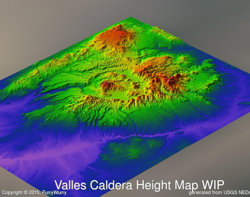

Although I've written a rough draft of Chapter 36 of Lagomorphs, it still needs a lot of work. I don't know when it'll be ready.
In the meantime, I've let myself be distracted by making 3D models of the Valles Caldera supervolcano, where Jeff's adventures are taking place.
Here's a WIP, showing a color-coded height map. The colors range from violet at the lowest altitude (~1500 meters or ~5000 ft above sea level) to white at the highest (~3500 meters or ~11,500 ft). Blue represents an intermediate height range, not water.
Although Jeff's adventures are purely fiction, the volcano itself is not. The maps are being generated from data downloaded from the USGS.
Submission Information
- Views:
- 379
- Comments:
- 0
- Favorites:
- 1
- Rating:
- General
- Category:
- Visual / Digital