Sign In
CloseMara Isle and Surrounding Islands (Map) by SpiderMilkshake (critique requested)
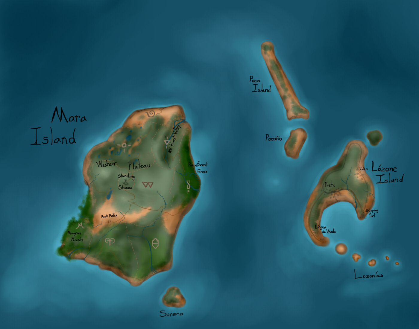


:D 'Bout time I finished this lovely top-down map of Mara Island--home of big cuddly snake peeps. Also includes the nearby islands, one of which has a few small settlements of hoomens on it. And most of the little ones aren't really worth visiting--they're fairly small so they have no large life and the small life is a bit scarce and less varied.
Anywho, Mara is about 8.5 miles in length from the northernmost point to the southernmost one (since I just remembered that I stupidly left out a scale... >.<). So a big island, but not impossible to trek over in one full day. Though it would be wise to take a detour around the tallest peaks, since the Garuda that live there might get dangerous, and also uphill sucks! XD
Map Key:
Green areas--Heavy Foliage areas. Brighter green is lush rainforest or mangroves/wetland forest, while regular jungle and meadows are duller green.
Brown areas--Areas with little-to-no vegetation. More orange-tinted brown is rocky outcrops and boulder fields, more sandy color is beaches and dunes.
Blue--Water sources, salt or freshwater.
Black text indicates the name of a region, town, or whole island.
Brown symbols indicate the Maranaga clan that lives in that area.
Pink dashes mark out the borders of clan regions.
Orange-brown lines mark out footpaths.
Grey lines mark out human civilization and paved roads.
Most of my Maranaga inhabit the southern section of the island, just next to the area with a lot of mangrove forest. Anik, however, lives in a seacave on the very northernmost point, and Petra, Muur, and Yma all live in the northwest section with lots of ponds and such. ^^ As you can tell, there is plenty of room for more nagies to take up residence.
Submission Information
- Views:
- 1244
- Comments:
- 0
- Favorites:
- 0
- Rating:
- General
- Category:
- Visual / Digital